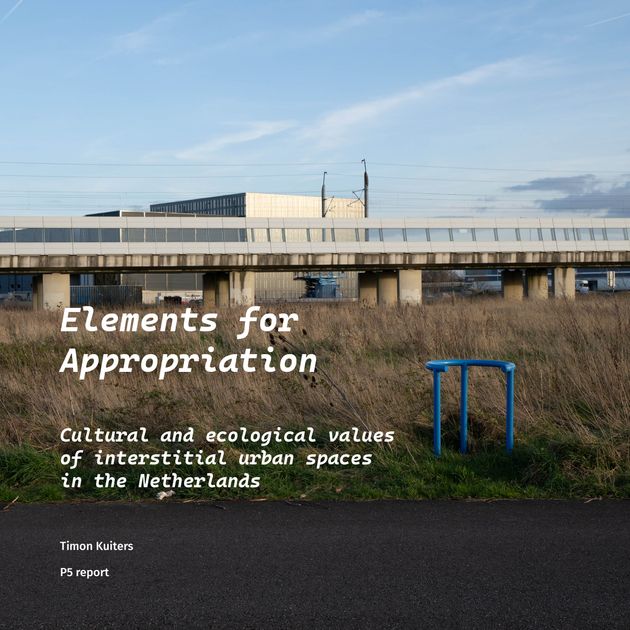
Elements for Appropriation
Cultural and ecological values of interstitial urban spaces in the Netherlands
Alexander Wandl
Adriaan Geuze
Interstitial urban spaces form an exception in the very organised urban-rural monocultural landscapes in the Netherlands. These unplanned in-between spaces are rarely valued from a traditional planning perspective, in which they are seen as “empty” or “unused”, thus ready for development. They are, however, an important refuge for people and wildlife alike, who do not fit in the monocultures of urban life and agriculture. However, the unplanned character that is core to their nature and arguably their value might be easily disturbed by design activities, and thus urban densification in the Netherlands is a threat to the existence of these spaces. The aim is to find a better way to describe, design and value these spaces. The research question is “How could urban interstitial spaces in the Netherlands provide cultural and ecological value?” Next to theoretical exploration, site analysis and fieldwork, explorative design is used to imagine how interstitial urban spaces could look and function to support and sustain the cultural and ecological values for the people and wildlife that make use of these spaces, could encourage bottom-up spacial development and inspire by illustrating what is possible.


Photography
The Lens of the Dutch New Topographics
The French term Terrain vague as related to interstitial spaces was introduced through discussing the medium of photography as it can be used to capture these places. Among the artists named by De Sola-Morales is Man Ray, who in his photo titled “terrain vague” uses his surrealist minimalist style to construct this image and capture the vagueness and intrigue of these places. Because of the ambiguous nature of both these places, and also of cultural value as a concept, this analysis is not so straightforward.
Jannes Linders, a Dutch photographer who makes photos of the Dutch landscape, is also mentioned by De Solà-Morales. He provides a more honest view of the Dutch landscape. There is still a subtle monumentality to the landscape, but the landscape is not an imagined unobstructed landscape where all the lampposts and infrastructure are hidden. In Linders’ landscape photos barely any people are present, which at first might seem like a limitation when analysing their cultural value to people. But it can also be a strength, as through how the viewer looks at the photograph, and the photographer at the landscape, you don’t need this third perspective of the person within the photo, those two are enough.
Linders is one of a number of Dutch landscape photographers that share a similar sensibility. A number of them - including Jannes Linders, Hans Aarsman, Theo Baart, Wout Berger - had their work exhibited together in the 2008 exhibition Nature as Artifice.
These Dutch photographers travelled the country with large-format cameras, making these composed and open shots of the landscape. The way these artists observe and capture the landscape in front of them has parallels in the mainly american movement of the New Topographics from 1975.
With these large format cameras their composition and viewpoint is always very deliberate, and provides an open frame by not looking at the landscape as framed by other objects, but instead they have landscape itself as their subject.
Their “democratic” perspective as it has been called provides context and shows what is there without much simplification. These are not details or overly manufactured photographs. In this way they do manage to highlight the juxtaposition of elements in relation to each other in a landscape.
Through resisting visual simplification but deliberate composition through choice of viewpoint they offer a unique perspective and interpretation of these places. Not an unambiguous explanation or interpretation, as it is not a text, but fitting for ambiguous interstitial spaces.
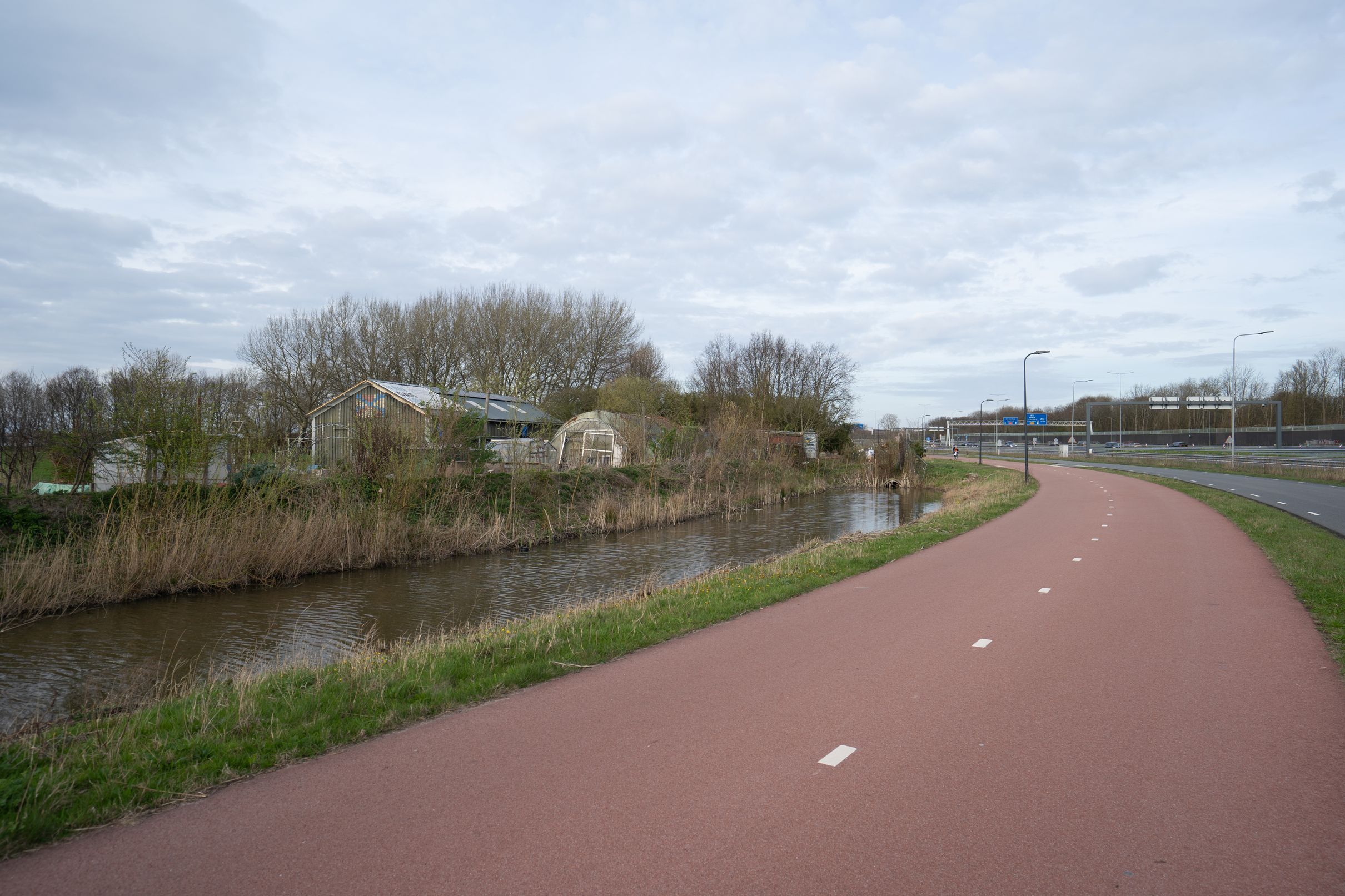
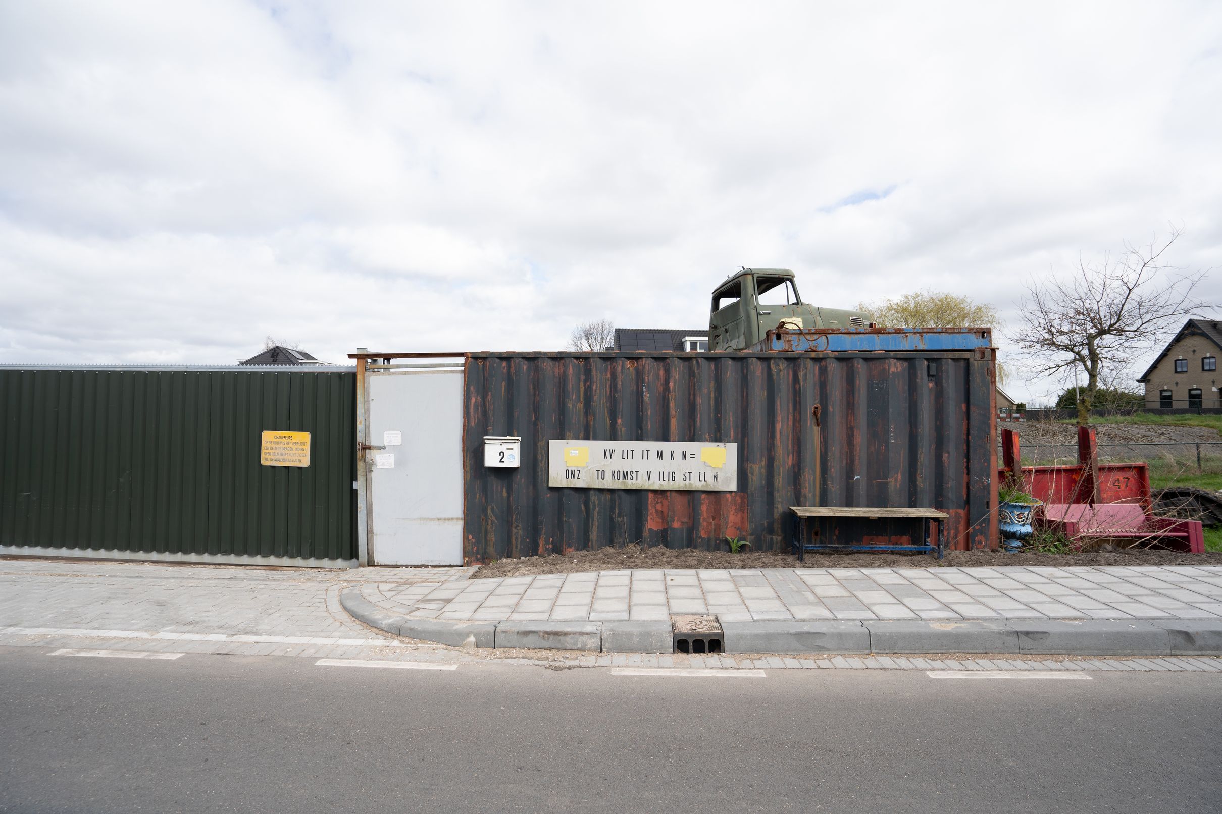
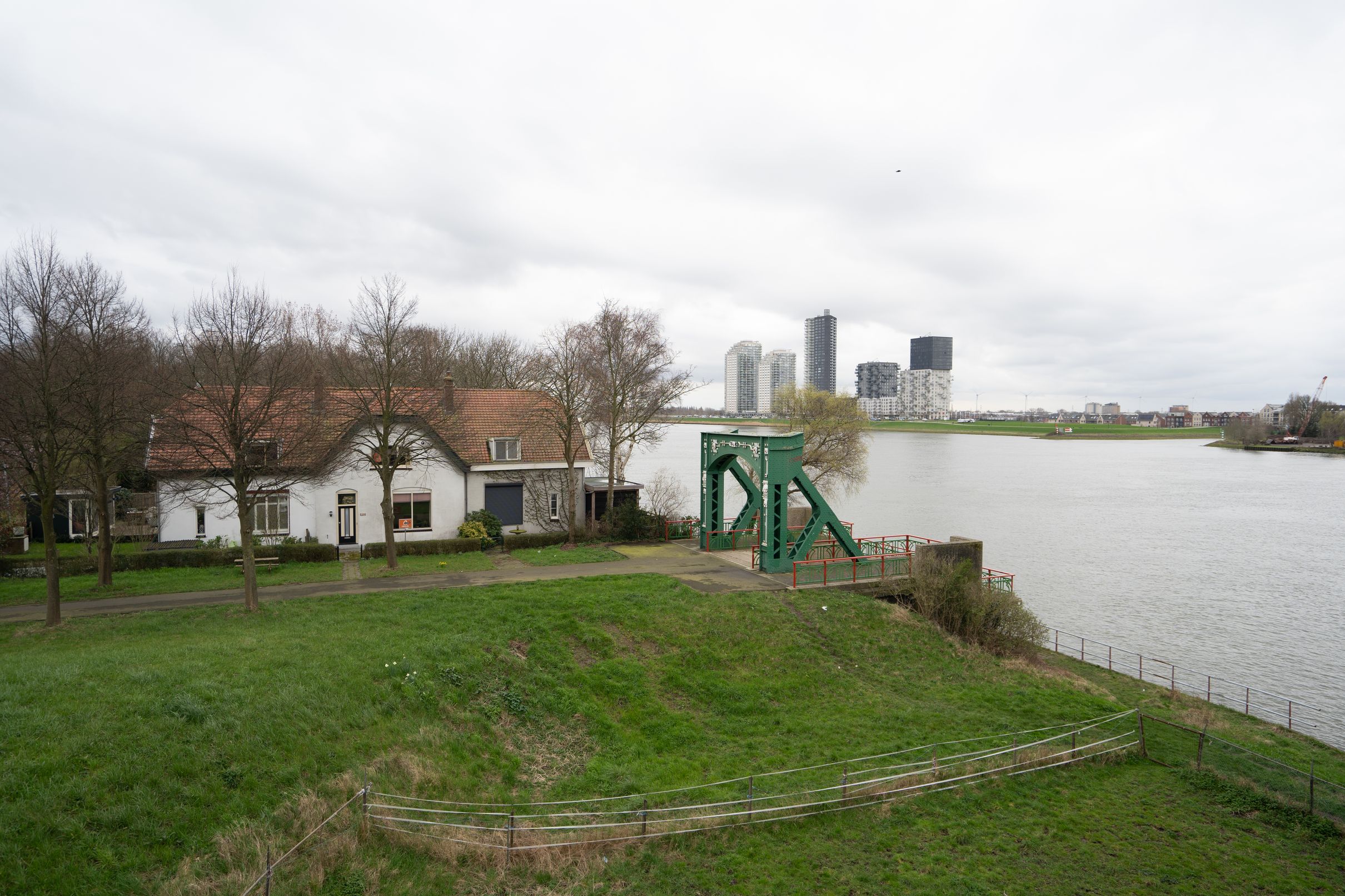
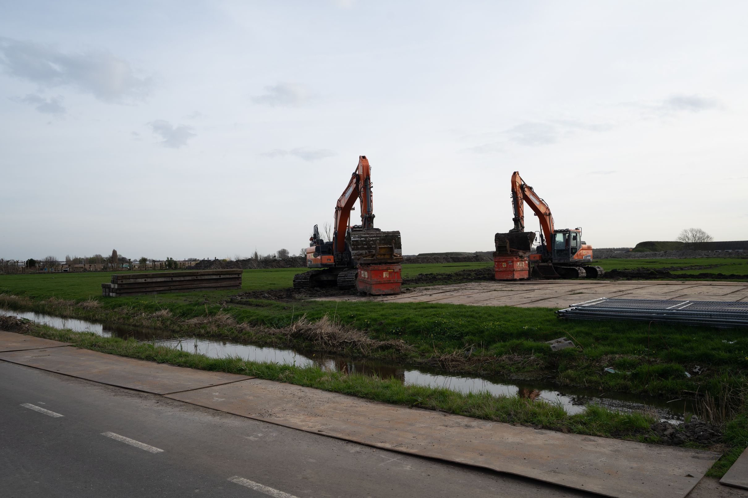
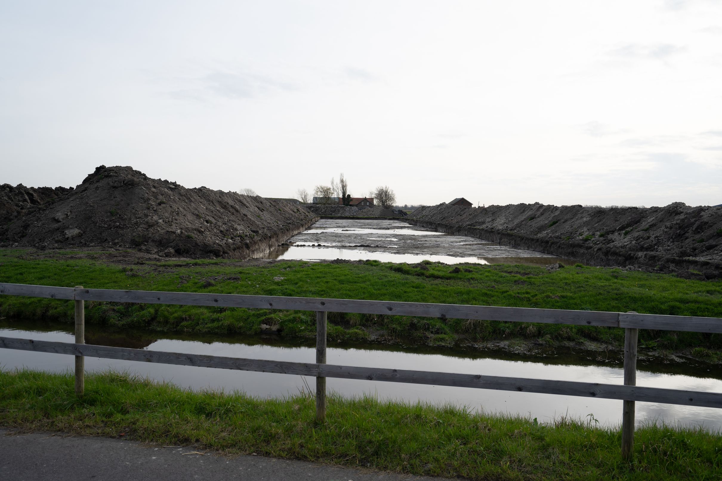
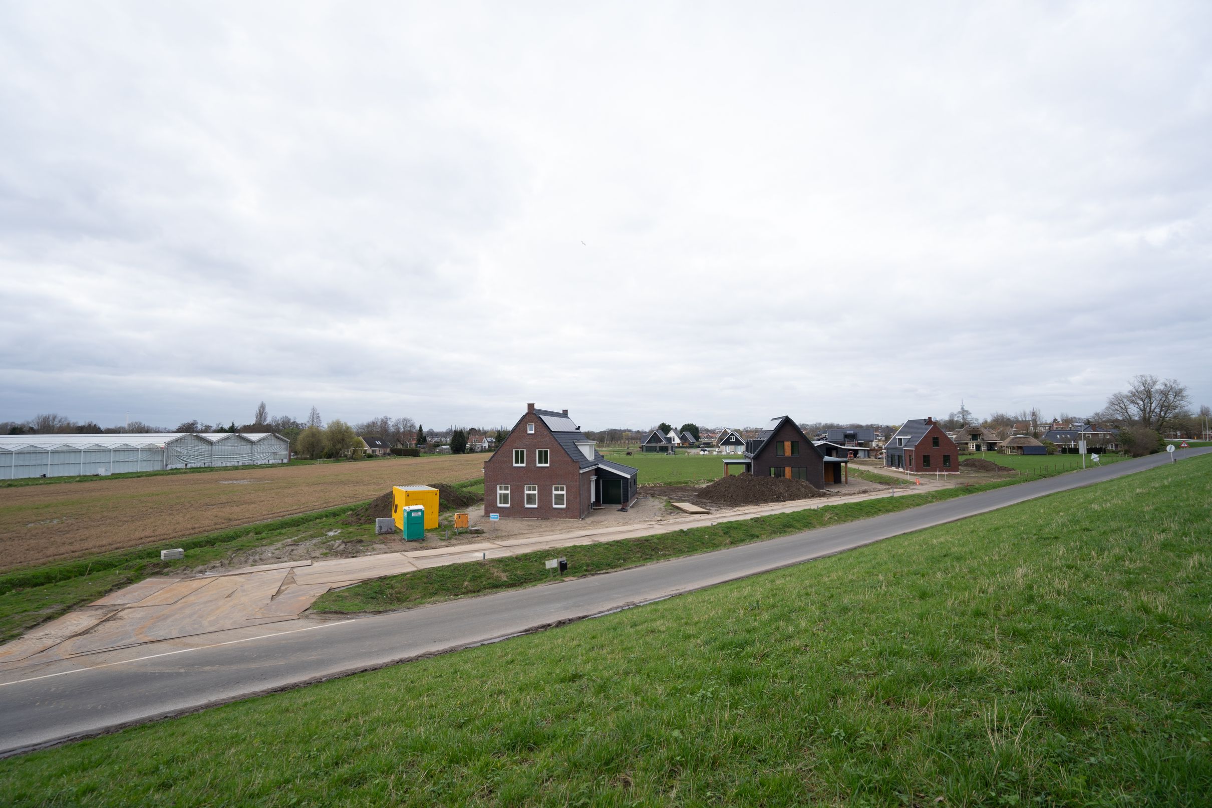
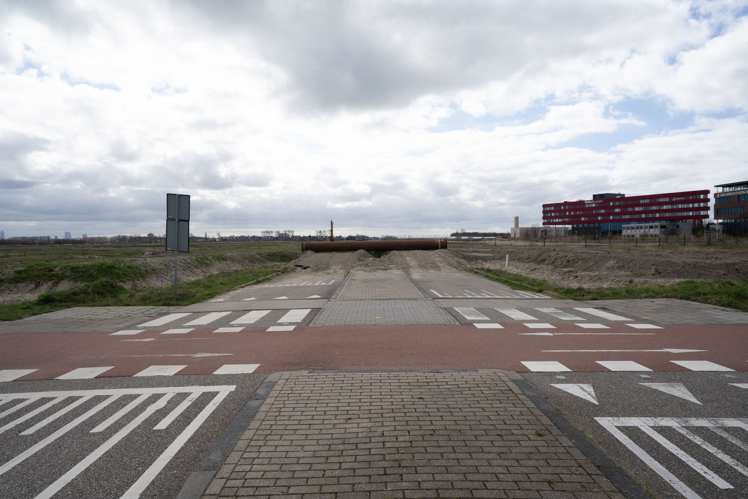
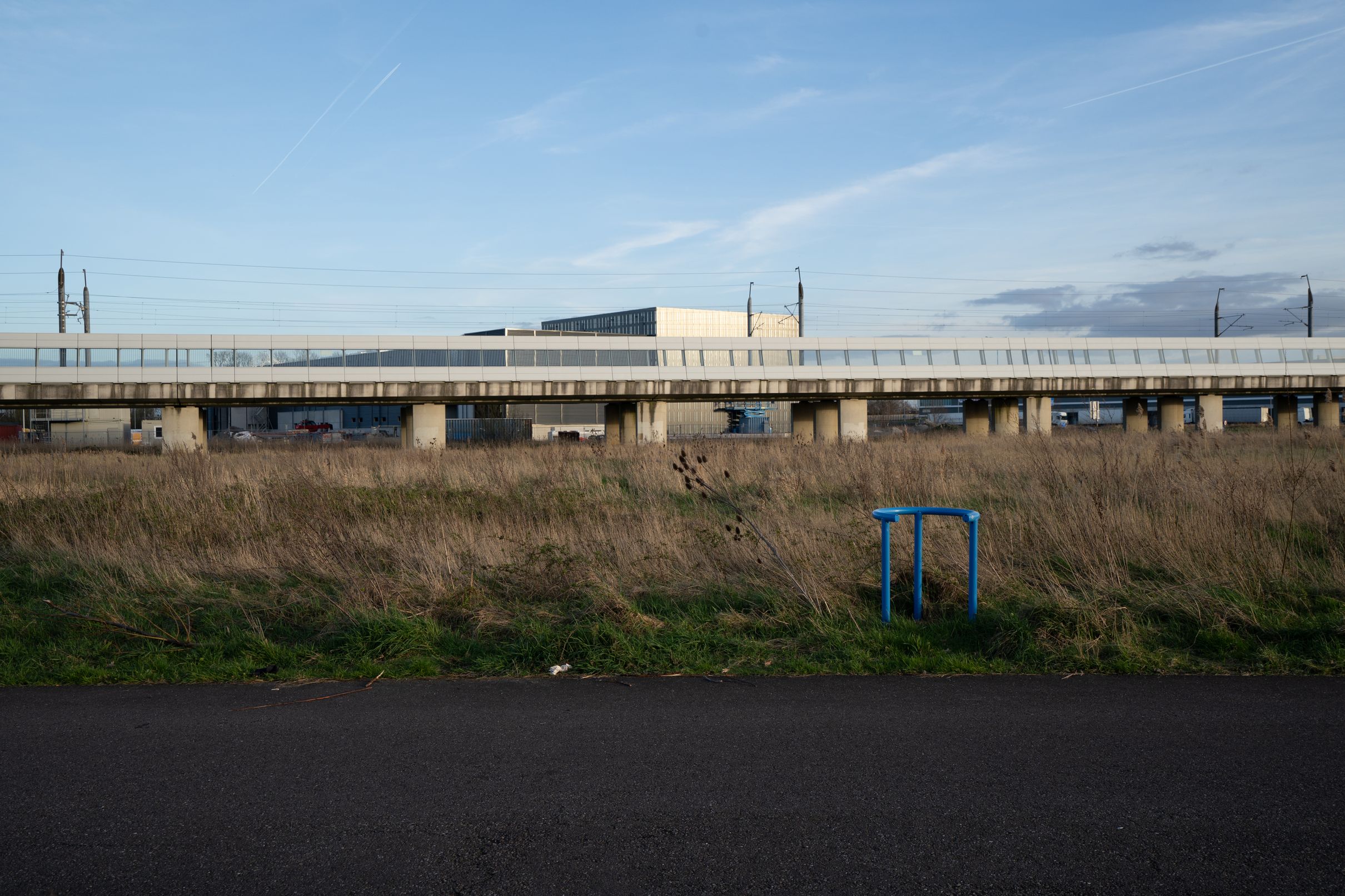
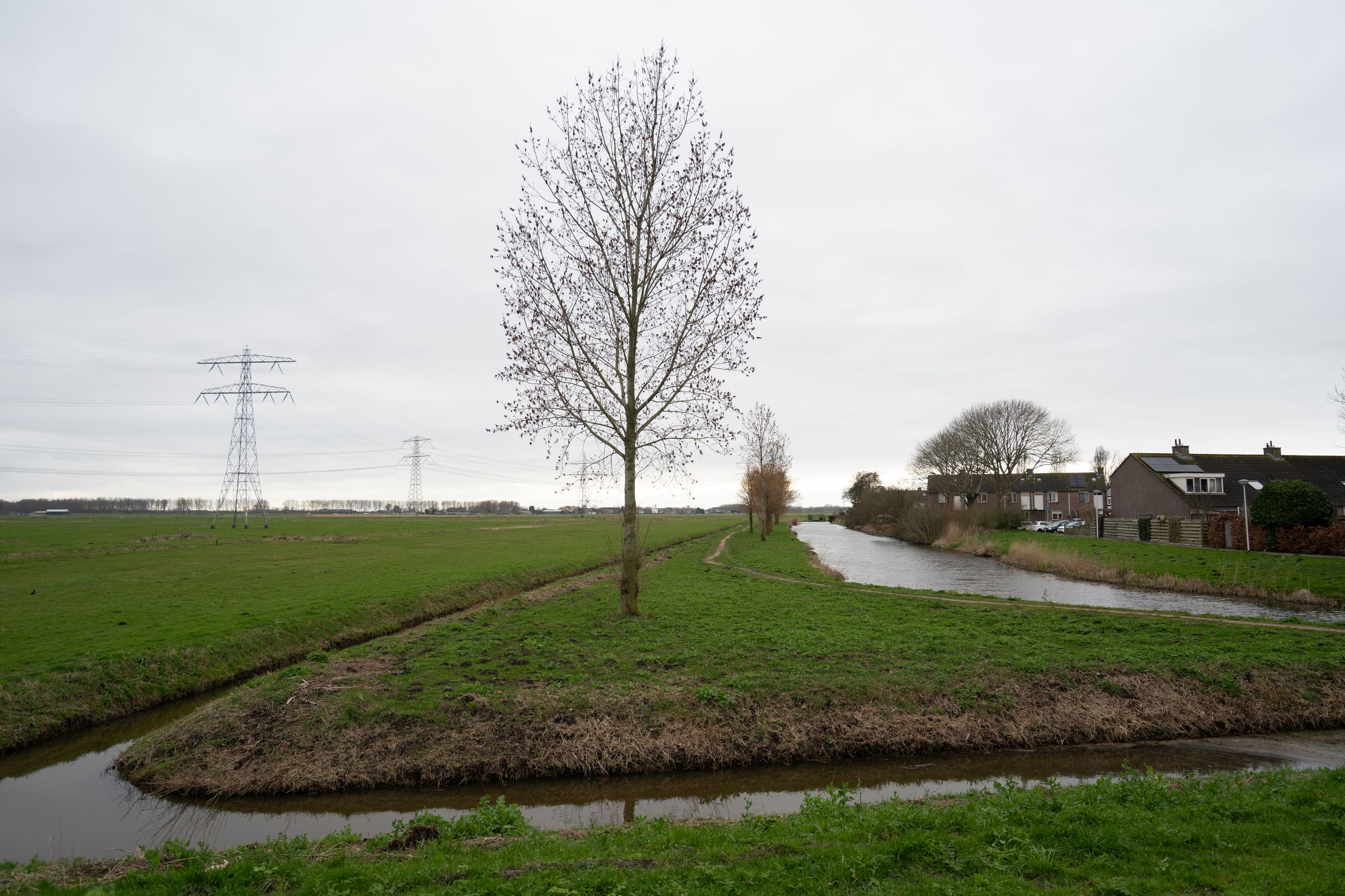
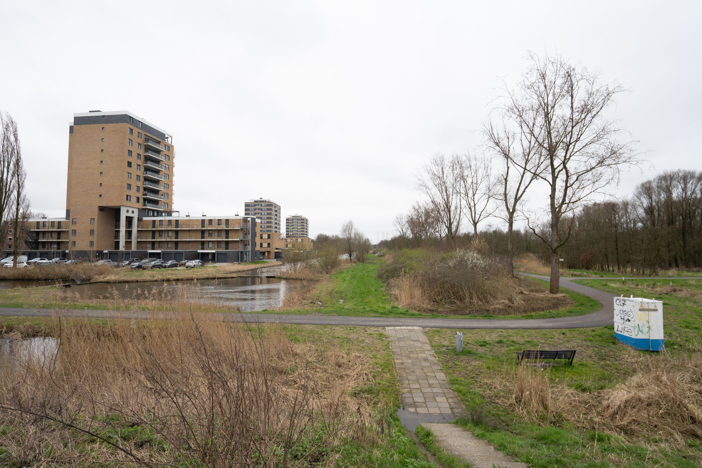
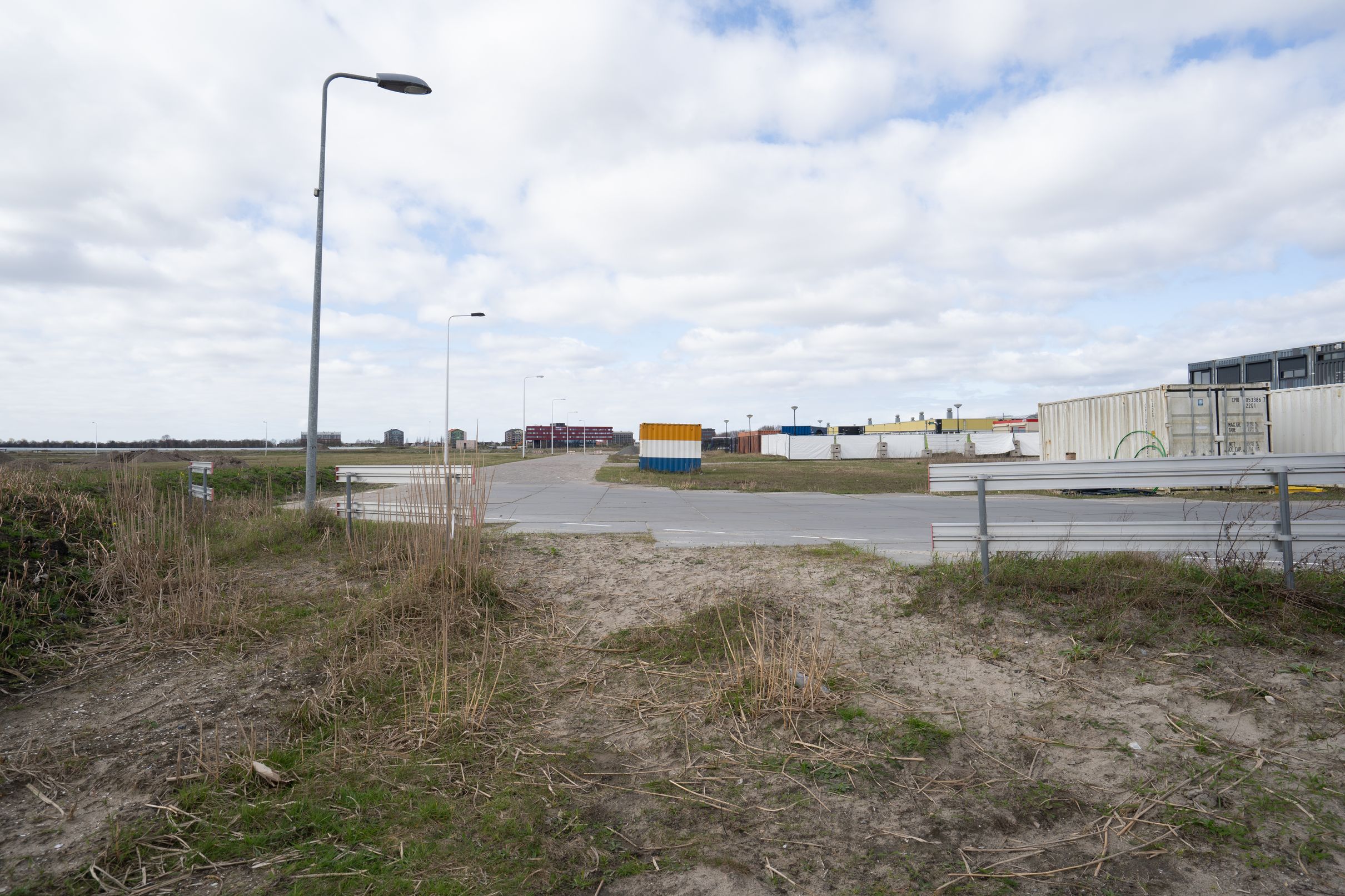
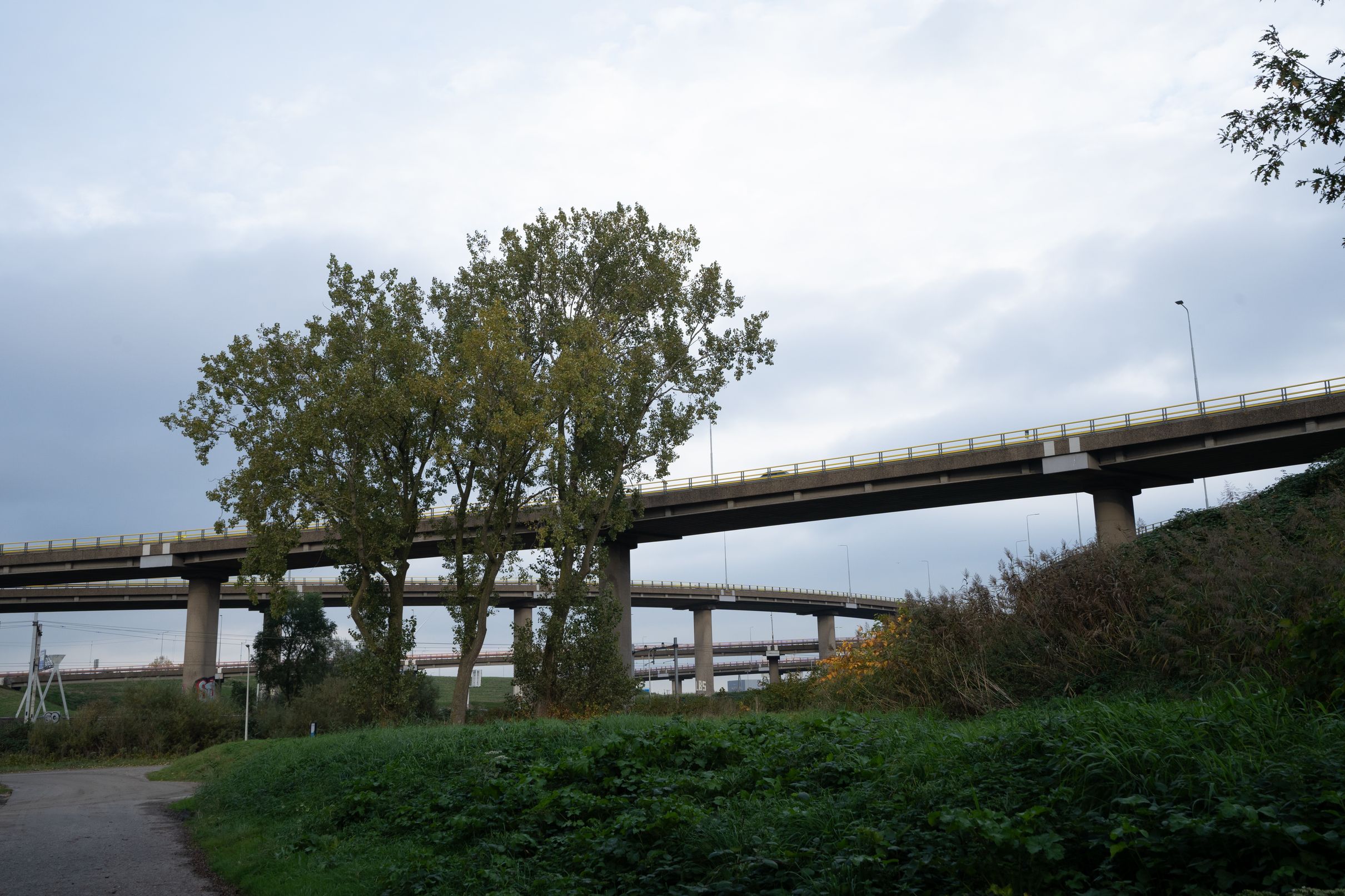
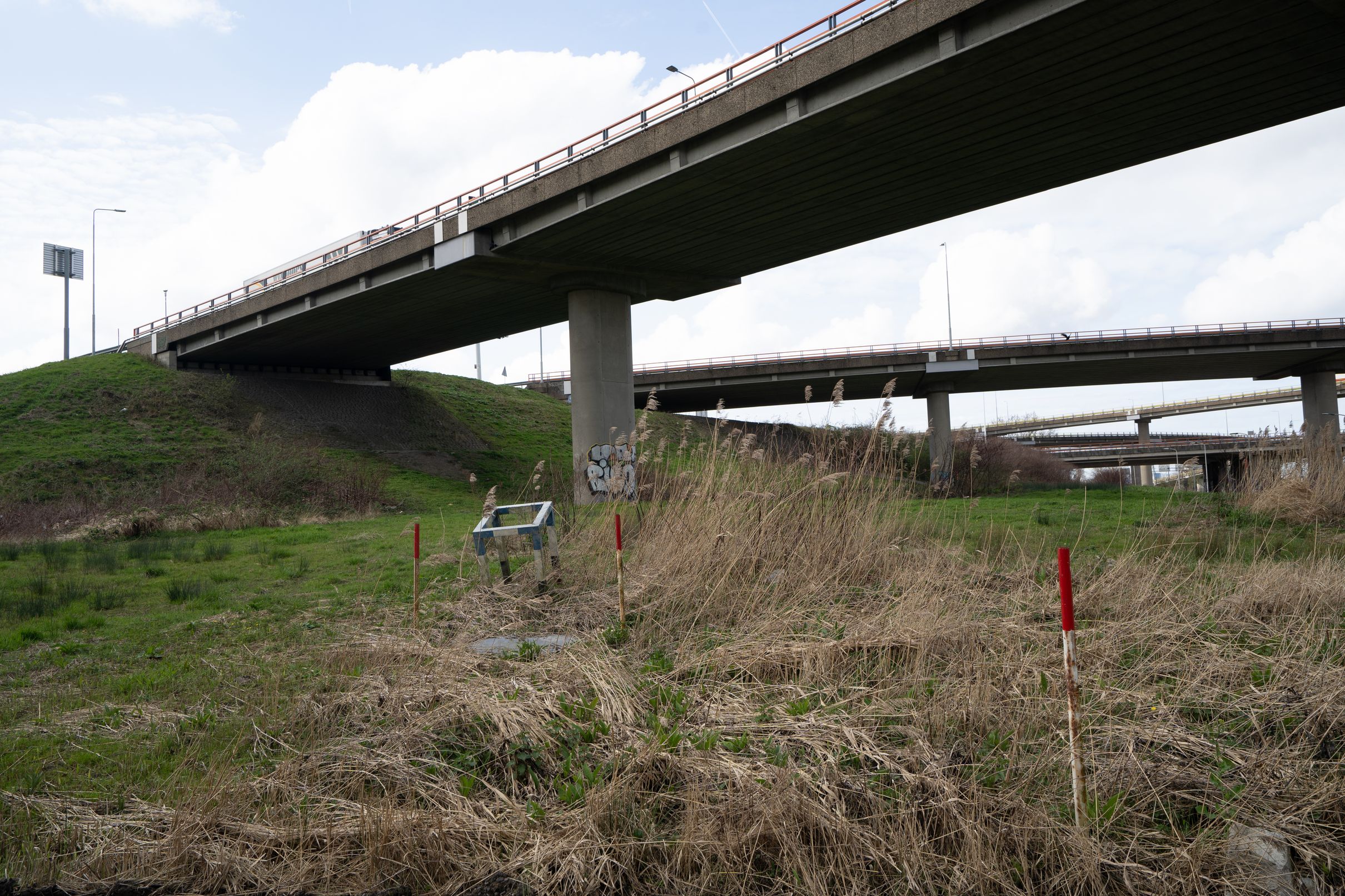
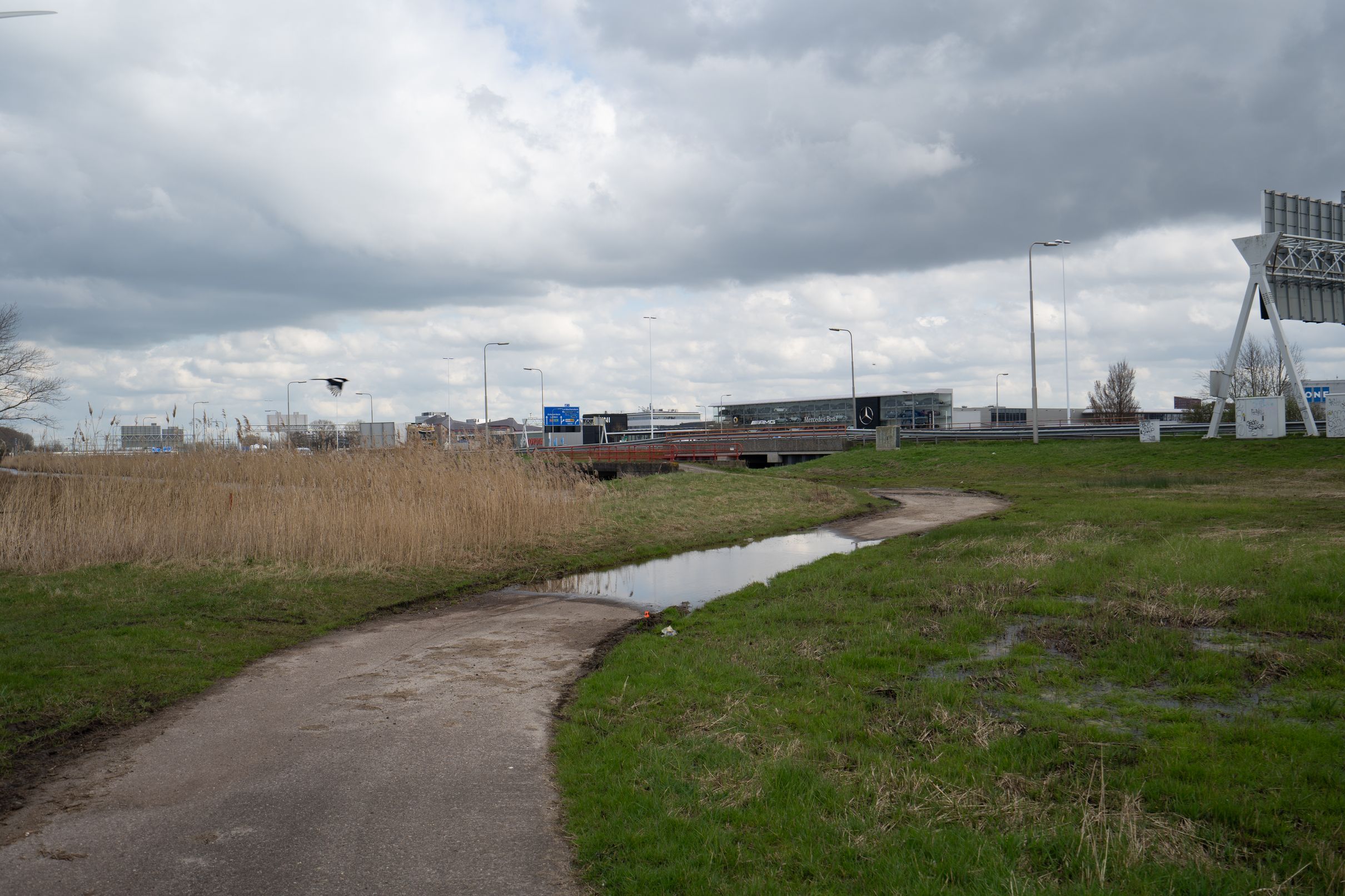
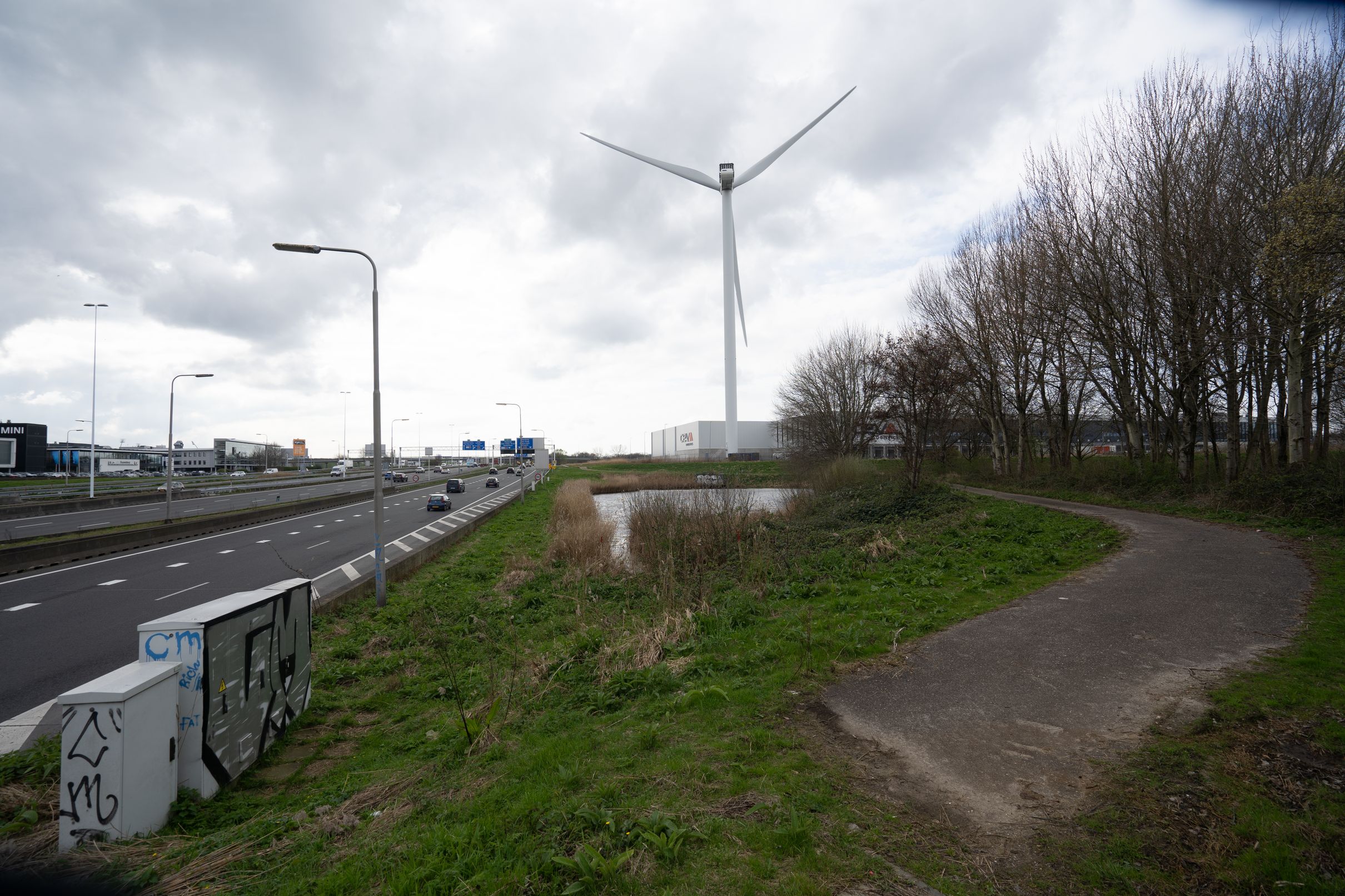
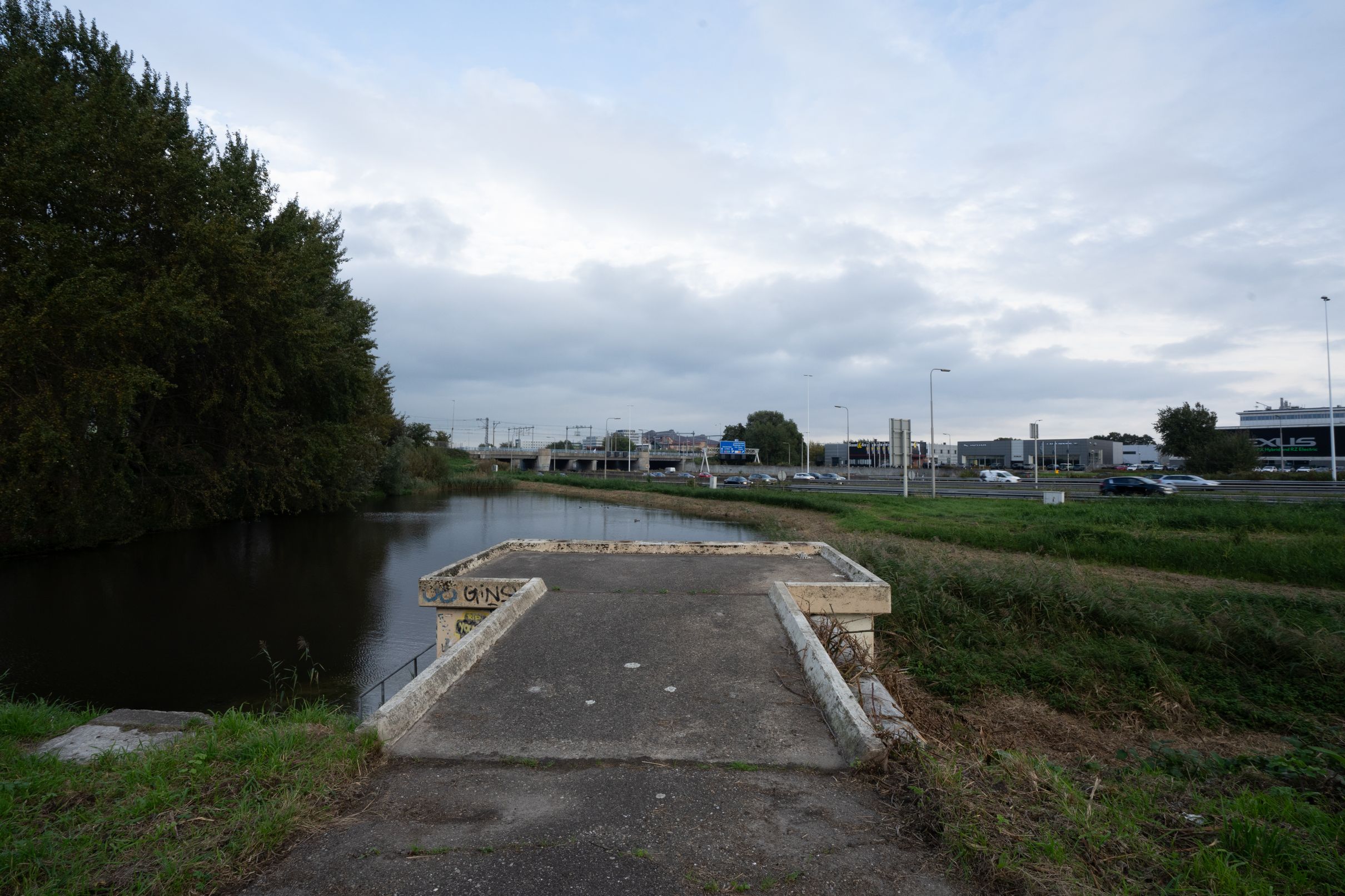
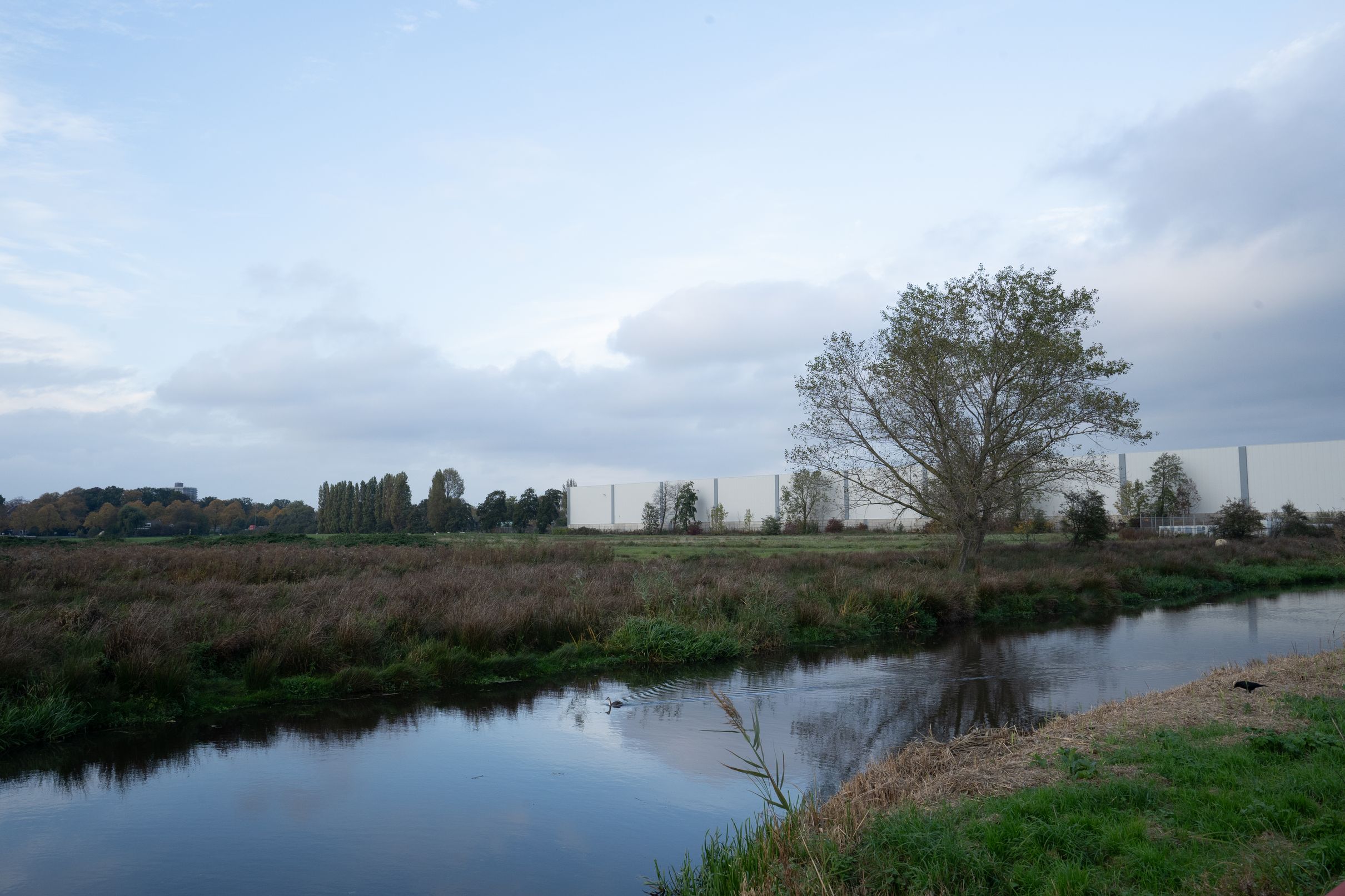
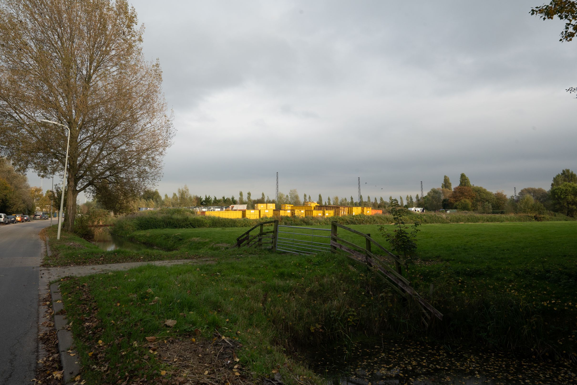
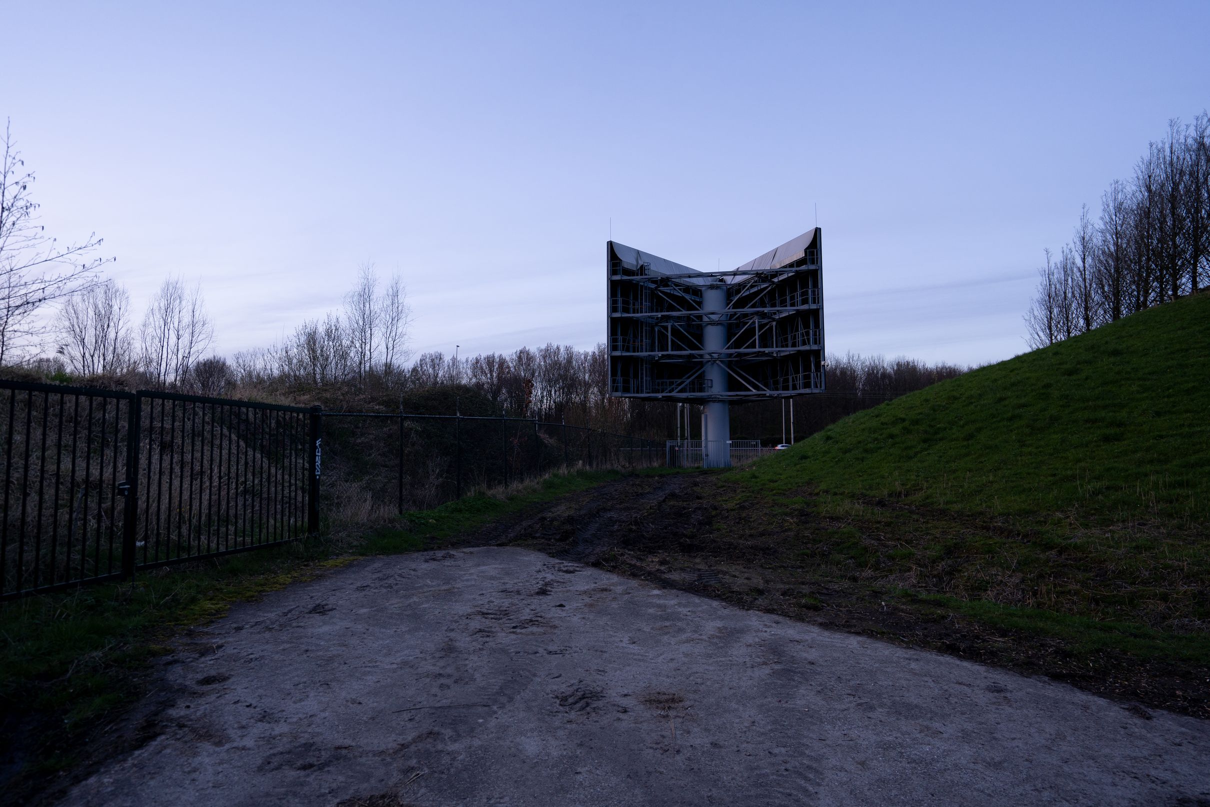
During fieldwork I went on cycling trips through my study area to look specifically at how these places were being used, to be able to explore their cultural value and qualities. In doing so I found it useful to use the lens of the Dutch New Topographics to observe. There were differences in my method, as instead of travelling by van, as some did, I chose to travel by bike. This meant I could not cover as large of an area as easily, but I could look around with more attention and stop more easily. I also didn’t use a large format camera on a tripod, but a full-frame digital camera, handheld. Still I did take extra care to compose the elements in each shot through a deliberate choice of viewpoint and to not just snap a picture. With a wide angle lens (16-35mm) to get an “open” picture of the landscape, keeping the horizon largely in the middle to avoid perspective distortion and allow for a more neutral view of the landscape.
Manifesto for interstitial spaces
Introduction
Where the elements for appropriation serve as inspiration for the potentials of strengthening the opportunities for spatial appropriation by both natural and human wildlife, here I outline a vision of how we could use planning instruments to protect and facilitate spontaneity in landscapes, and how putting this central in spatial development practise could improve the practise of spatial planning itself.
While the Netherlands is a very neatly organised country, it is in the urban fringes we encounter the limits of this organisation. They are still quite neatly organised and delineated, and yet not place-specific. A way to deal with these places is place-making, where designers impose their vision of a place onto a site, which is then often related to phenomena like gentrification. This top-down design-led approach only furthers organisational desires. Instead, we should embrace the qualities of these tussenruimtes or interstitial spaces to use those as a basis of urban development.
This shift from continual new project development to focus on bottom-up spontaneity in which individual and collective care for space plays a significant and shaping role for spatial development helps in shifting the emphasis from an economy dominated by a free market system to also include other economic principles like householding and reciprocity (as outlined by Polanyi and elaborated in the theory chapter of the report).
Urban interstitial spaces in cities offer space in an urban context for functions that don’t fit anywhere else in the planned urban area. A core strength of these “left-over” areas is the spontaneous development that can take place, both ecologically and culturally, which is vital for the culture and ecology of the city. As left-overs from spatial planning projects, these spaces are undervalued. But if the strengths of these spaces are enhanced, they can play a key role in improving urban development.
To accomplish this, changes in policy and maintenance at two different scales are needed, from within and from around these interstitial spaces, that aim at protecting these spaces and putting their strengths central in spatial development.
Definition/designation
First, an official definition and delineation of interstitial spaces is necessary, and a prerequisite for policies to specifically target these spaces. Buffer zones and spaces surrounding existing and new spatial plans should be designated as such interstitial spaces. In this the core of the plan and its fringe should be taken into account, and the fringe if not a main purpose of the plan (such as a crucial park) should be labelled as “interstitial” space.
Part 1: Protecting the typology of interstitial space
These areas often span boundaries of different municipalities, thus a separate inter-municipal organisation is needed to unify their maintenance: Tussenruimte-beheer, tasked with the management and maintenance of these newly defined interstitial spaces. Their mandate should be to use the spaces they manage to protect and enhance their value as spaces for spontaneous ecological and human development.
In these zones, there should be a mandate for minimal maintenance. Lawn-like grass fields will transform into valuable grasslands, by mowing less but more purposefully. Hedges will be trimmed less to allow a new urban wilderness to flourish. This encourages spontaneous natural development and helps in the development of valuable ecological systems.
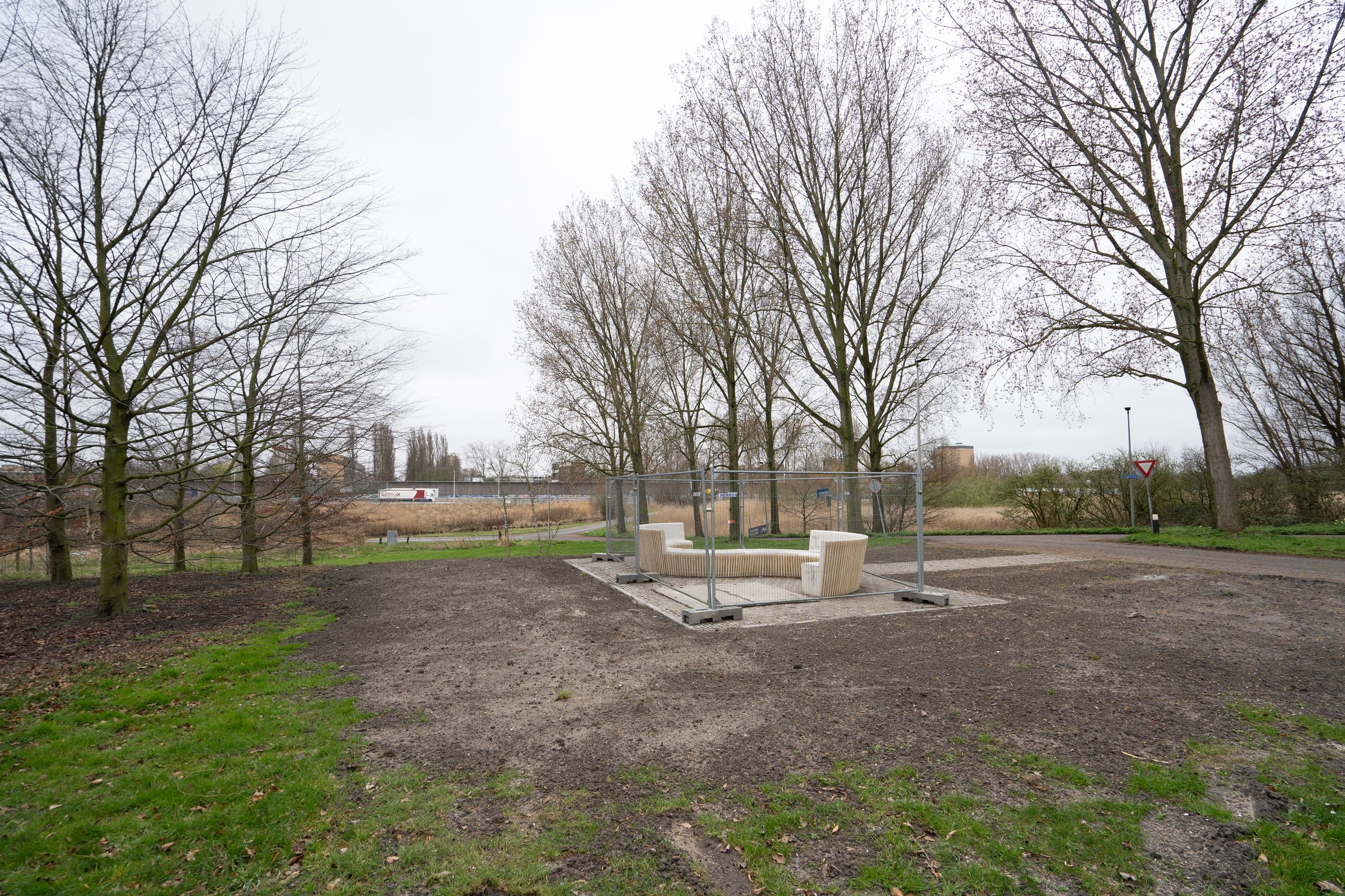
At the same time, money saved by practising minimal maintenance should be reinvested in the same zones to encourage people to appropriate the space and make it their own. Among this new urban wilderness, which to people can give an disorderly and uninviting impression, should be elements for appropriation as cues to care: small designed interventions that invite to appreciate, participate and appropriate the space. While tussenruimte-beheer is responsible for the selection and budgeting of these interventions (from budget saved by practising minimal maintenance) they should be built by individuals or collectives with the requirement they are accessible to the public.
While these elements for appropriation should kickstart and inspire more spatial appropriation, in-between zones should then also have a higher tolerance for self-built basic structures, thus encouraging this bottom-up development.
As a consequence of these mandates, interstitial spaces will be empowered to develop in the properties that make them most valuable: providing space for spontaneous development of both wildlife (through limited maintenance) and people (through elements for appropriation and tolerance for other basic structures). These spontaneous bottom-up developments can be the key to new forms of spatial development.
Part 2: 15 year interbellum
Next to using and expanding the values of interstitial spaces for spontaneous development, the continued existence of the typology of interstitial spaces should be protected.
Space, especially in the Netherlands, is a limited resource. To protect our non-urban areas, urban expansion as practised in the past cannot continue. This is why there is an increased focus on densification as opposed to expansion. However, in doing this, we must also take into account the protection of the valuable typology of interstitial spaces. These spaces are inherently temporary in character, traditionally forming at the fringes of a growing urban area, or staying behind as a city shrinks. In a future where new spatial development takes place within existing boundaries of urban areas to protect the spaces beyond those boundaries, the places that exist on those boundaries should not be forgotten.
The temporary character inherent to interstitial areas, originating from urban expansion, must change. One could imagine either the loss and decline of interstitial spaces as more are taken over by urban project development, or their fixation in time, both of which would be detrimental to their inherent character. Instead, we should protect the typology of the urban interstitial space.
A sustainable method is needed to guarantee the existence and utilise the bottom-up development strengths of interstitial spaces in such a circular spatial development system.
When an urban area loses its old function - industry moves, infrastructure patterns change, or buildings don’t conform to contemporary needs - there would either be a building-level transformation to adapt it into a new function, or new urban project development. The possibility of this new development drives land price speculation, exacerbating the price of new housing. Instead of allowing this immediate project development, in any urban area that loses its old function no new project development should be able to take place for at least 15 years. Instead, this new interstitial space would be put under management of tussenruimte-beheer. This measure should have a negative effect on speculation with land price as any new vacant land can’t be used for expensive new project development in the short term, and protect the continued existence of the typology of interstitial spaces.
Part 3: Spontaneous development as basis of spatial planning
When traditional project development takes place, interstitial spaces are turned into urban spaces. In a system of sustainable urban development inclusive of interstitial spaces, traditional project development in an interstitial space should only be allowed when a new interstitial space becomes available in the same urban region. In this cyclical system for a post-urban-expansion context, when an urban space would traditionally be redeveloped from vacant land, it instead has to be nurtured as an interstitial space for at least 15 years. A different interstitial space that has existed for at least 15 years can be redeveloped instead. These places to be redeveloped won’t be “vacant land” though. They will have been appropriated by nature and people in various ways. Bottom-up spatial development nurtured by tussenruimte-beheer can form a basis in redevelopment plans, helping make traditional development more organic, less top-down and more inclusive.
By protecting and enhancing the qualities for spontaneous development of urban interstitial spaces, and protecting their existence and strengthening their constructive role in a cyclical urban development, the developments of these spaces can form the basis for a new kind of spatial development that is more participatory, place-specific and help serve the needs of the city over the monetary interests of project developers more directly.